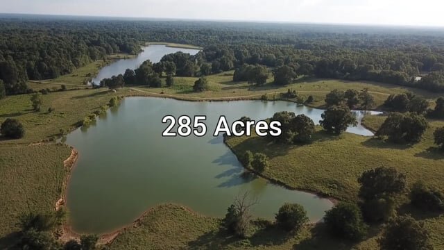
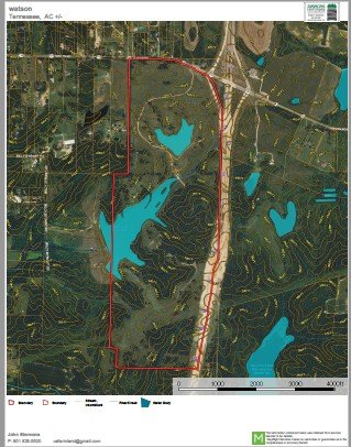
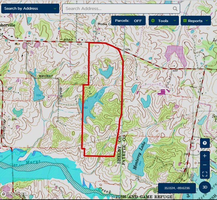
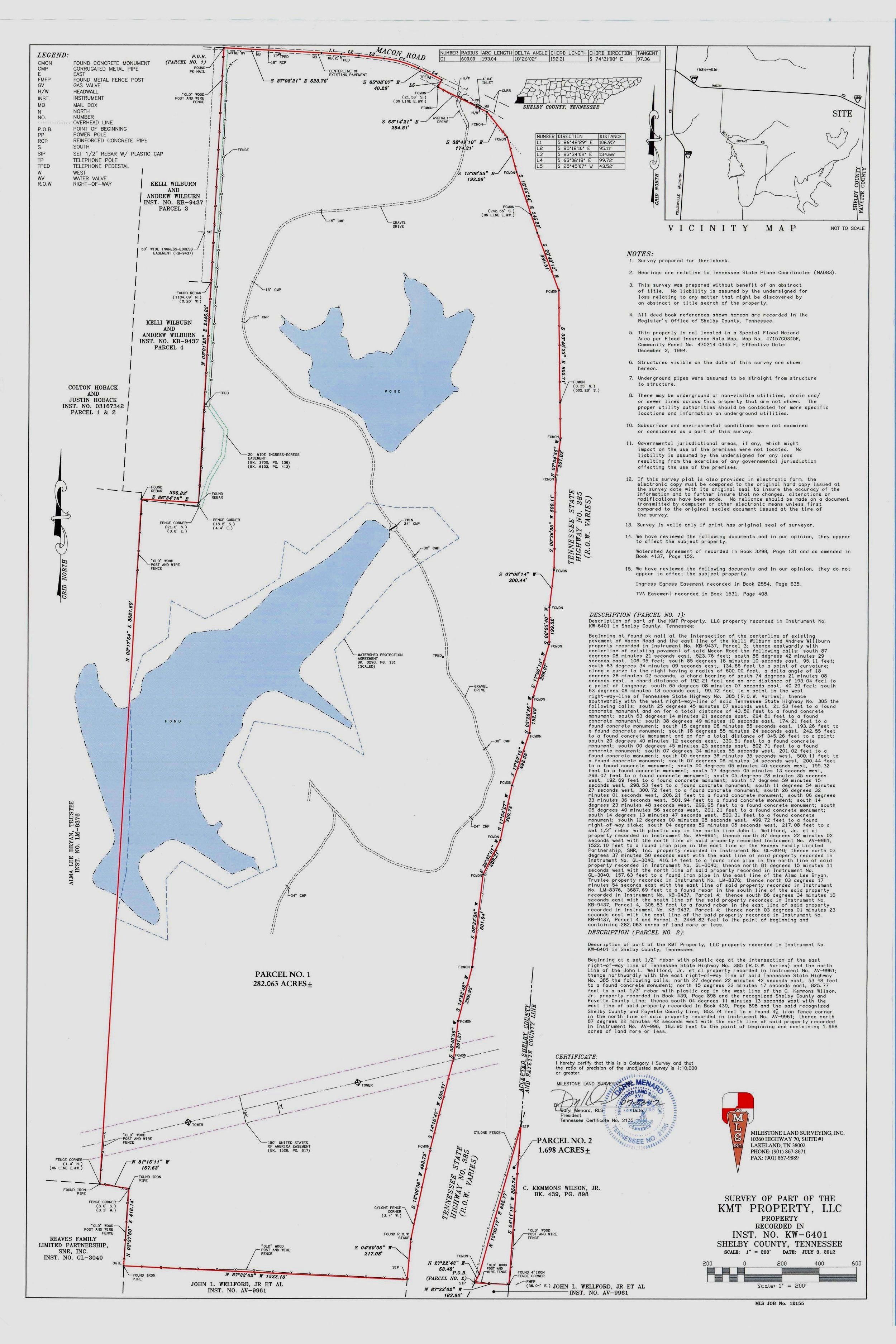
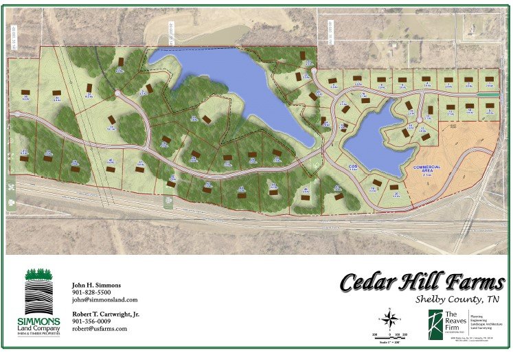
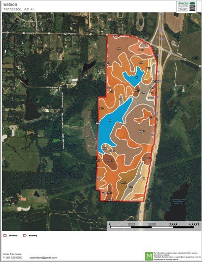
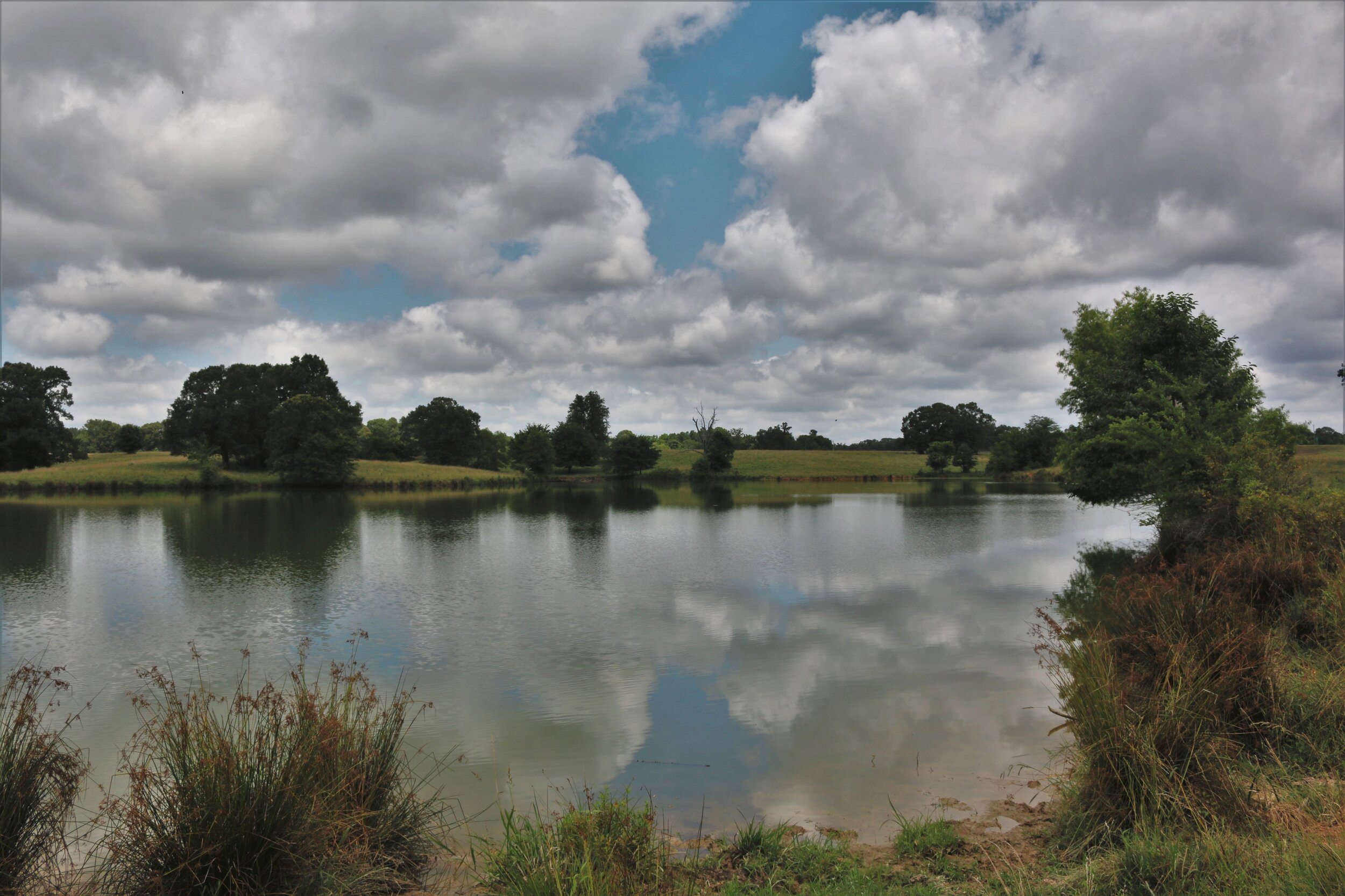
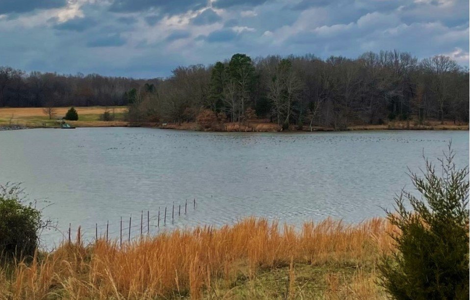
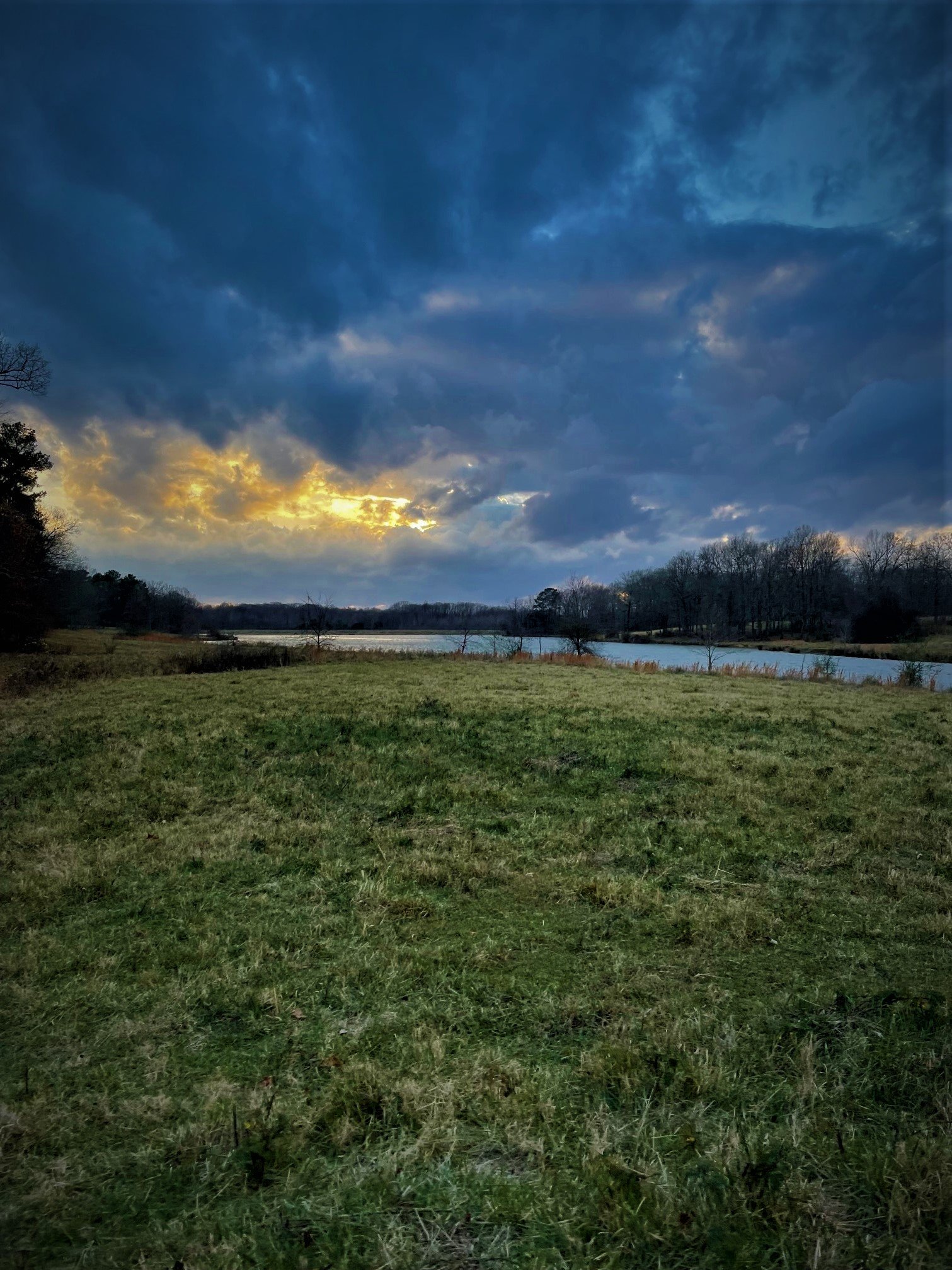
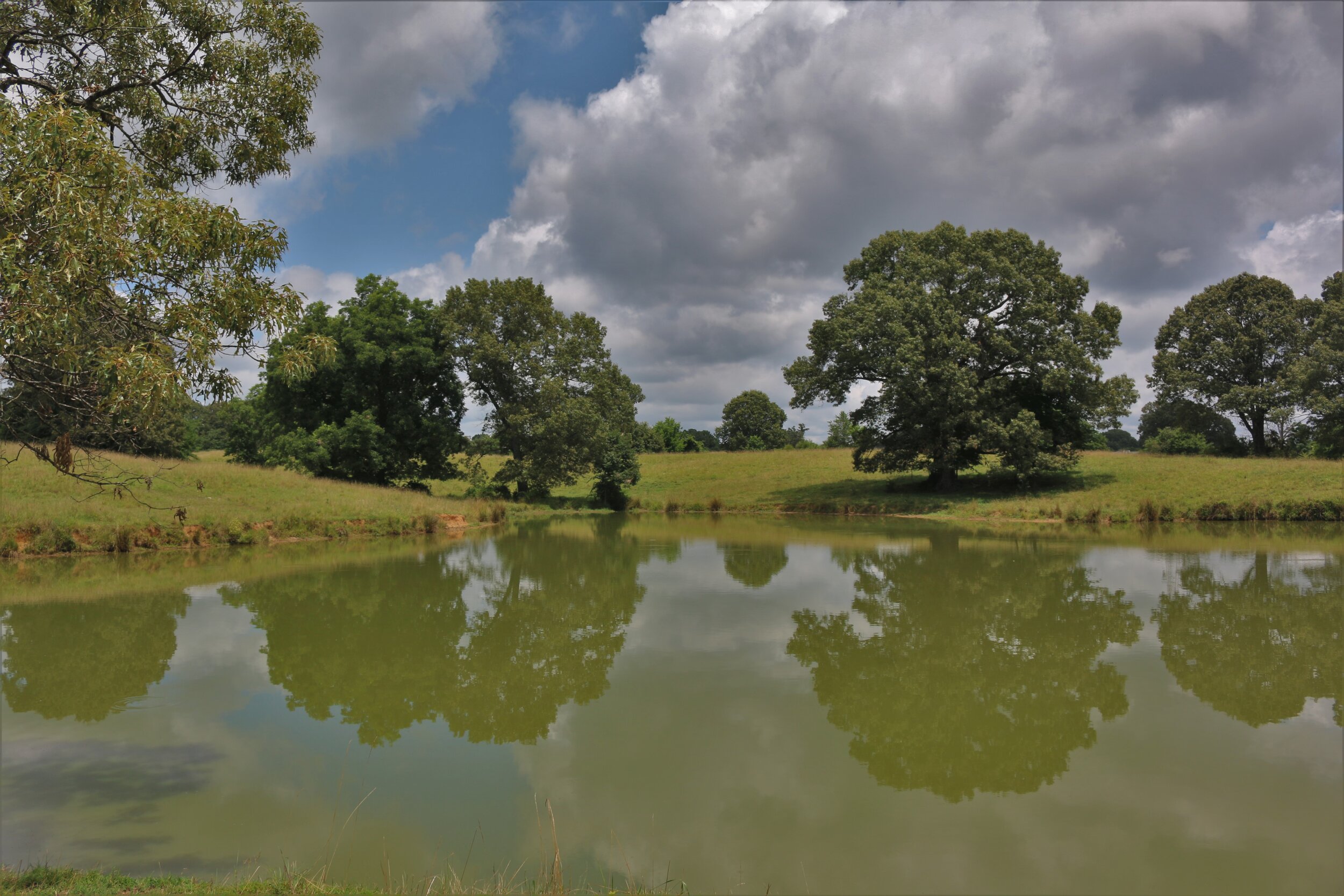
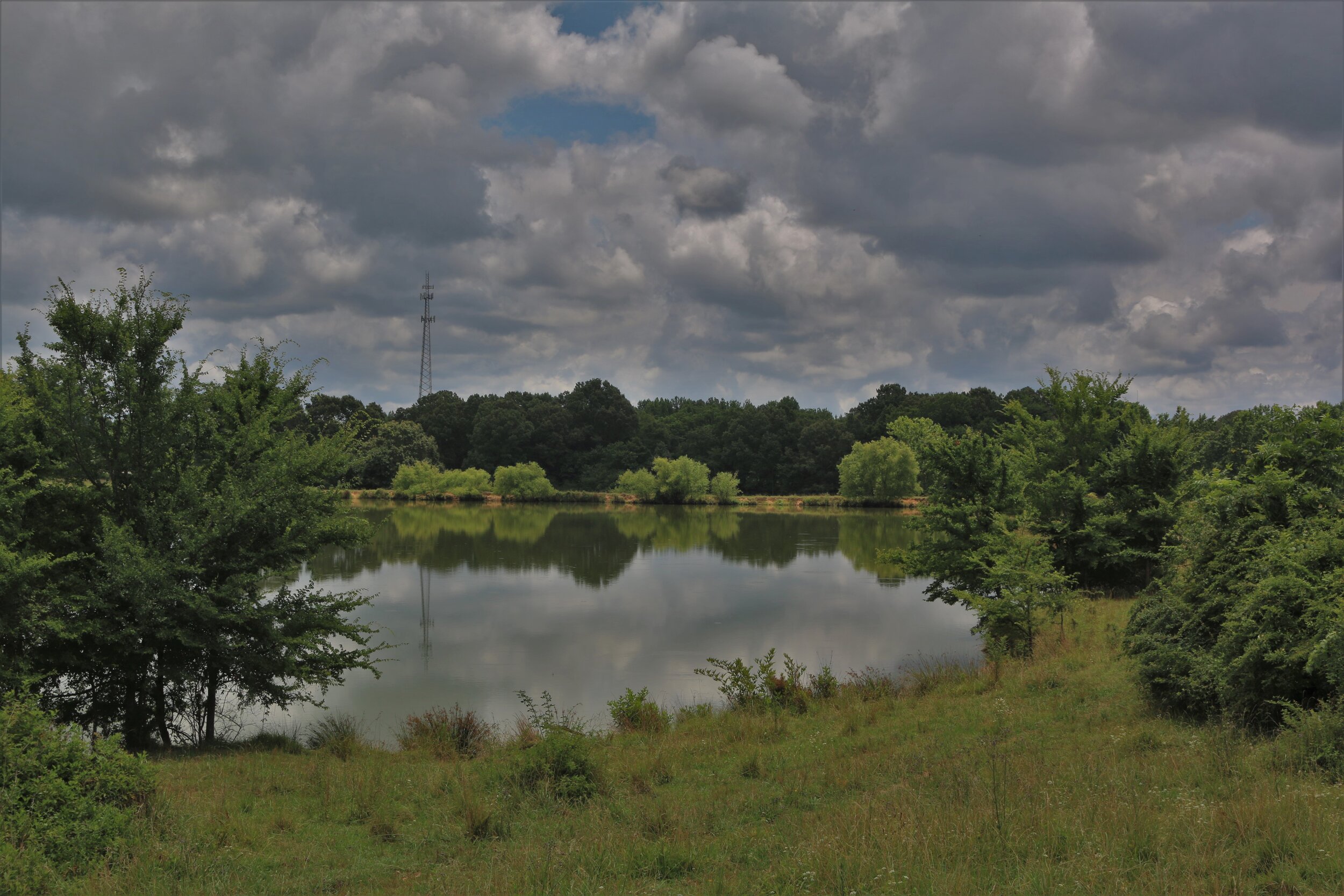
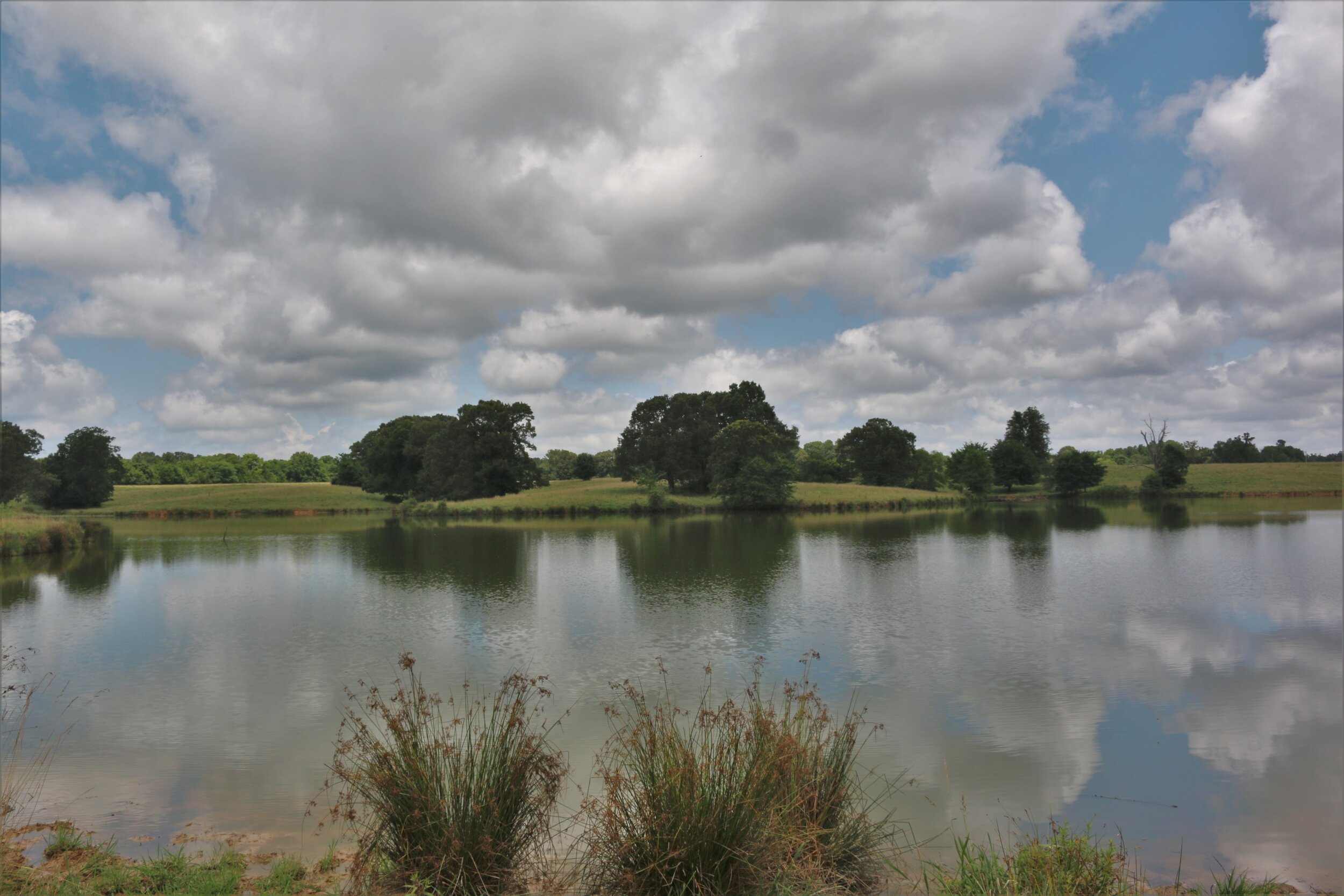
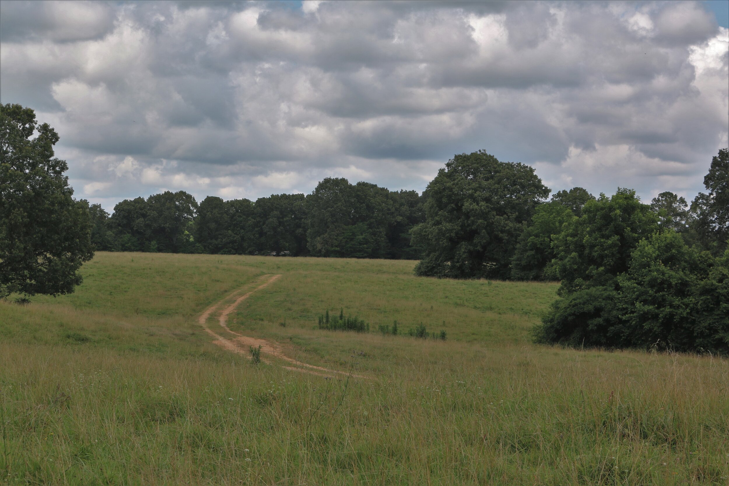
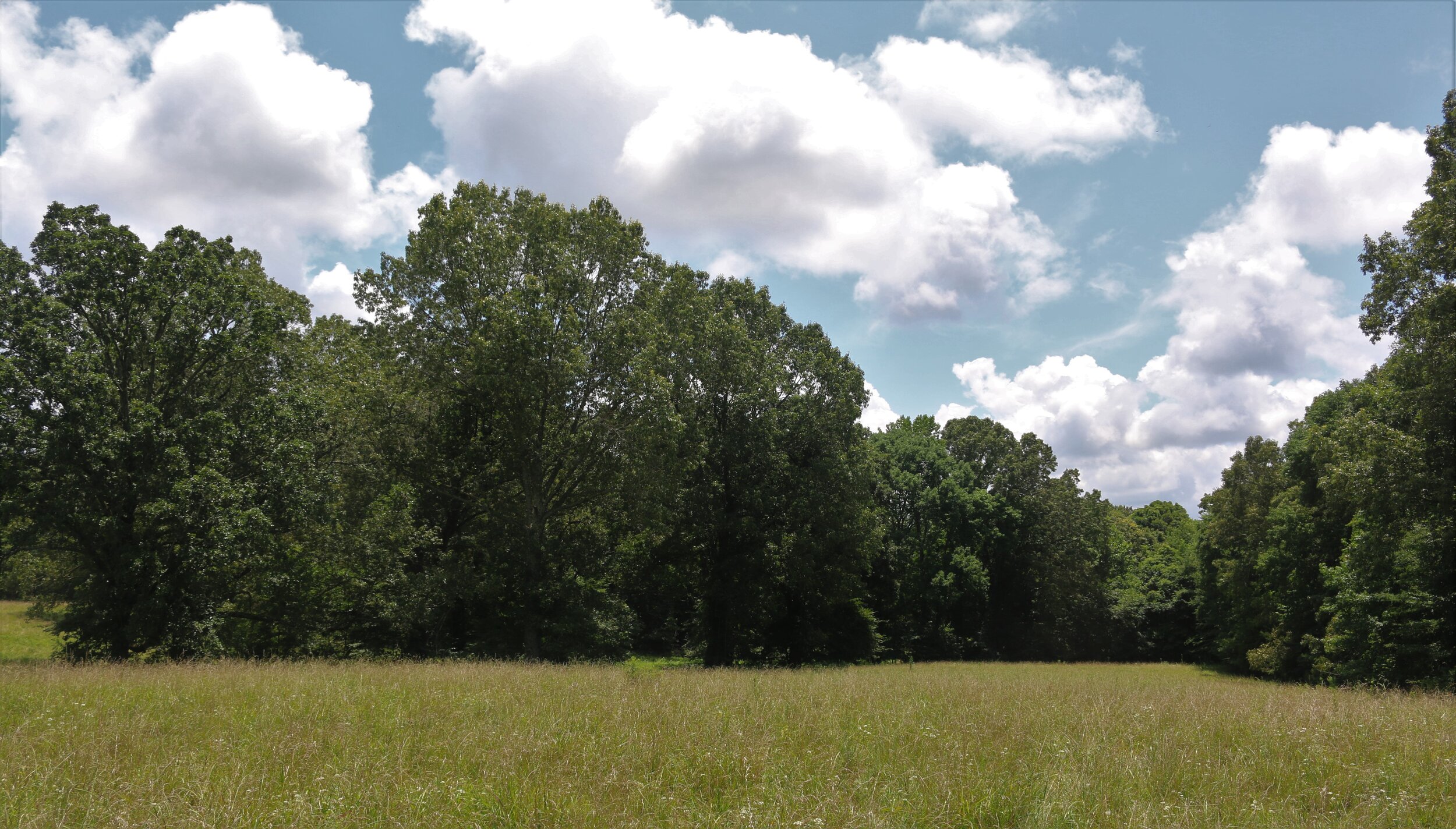
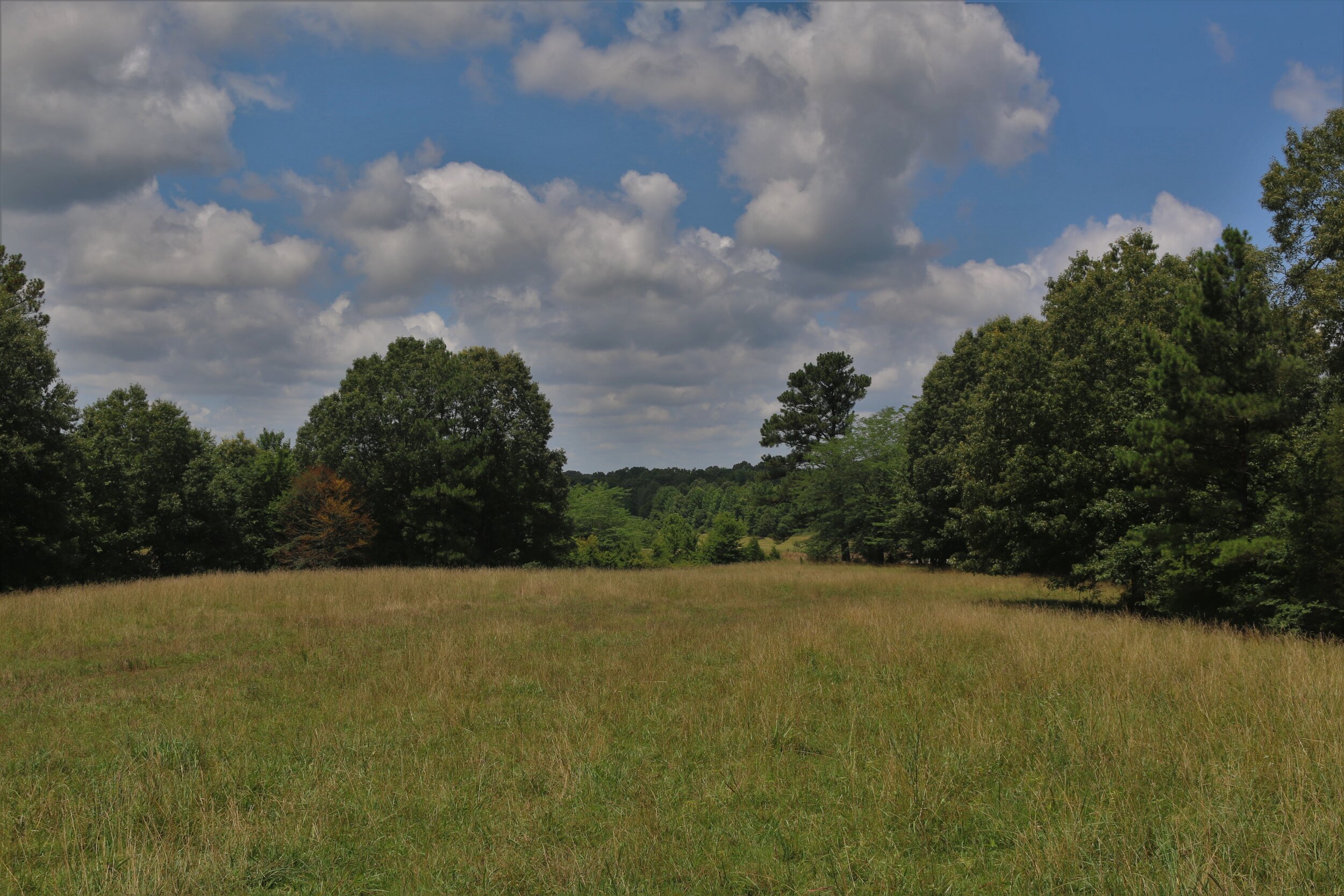
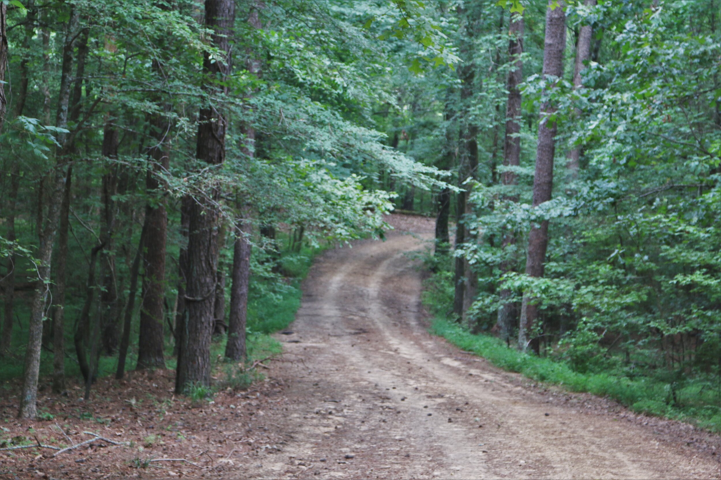
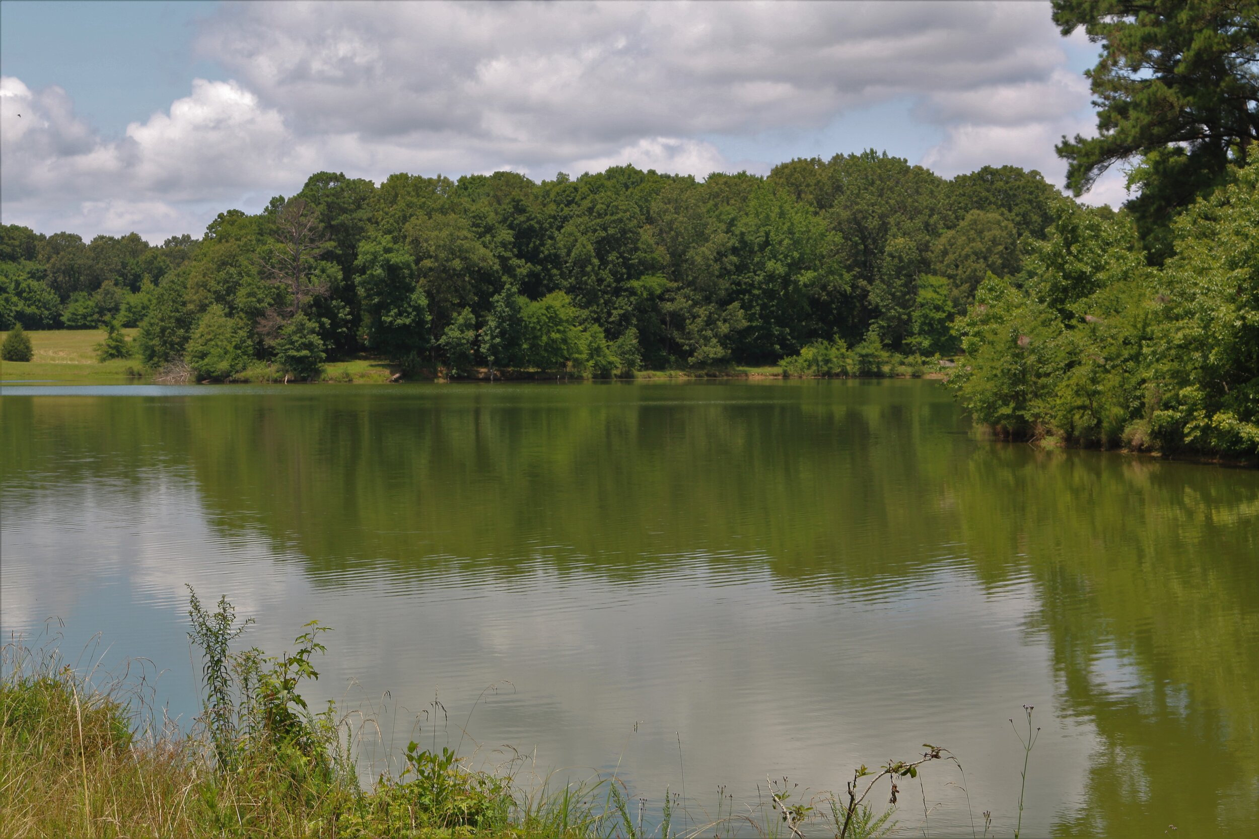
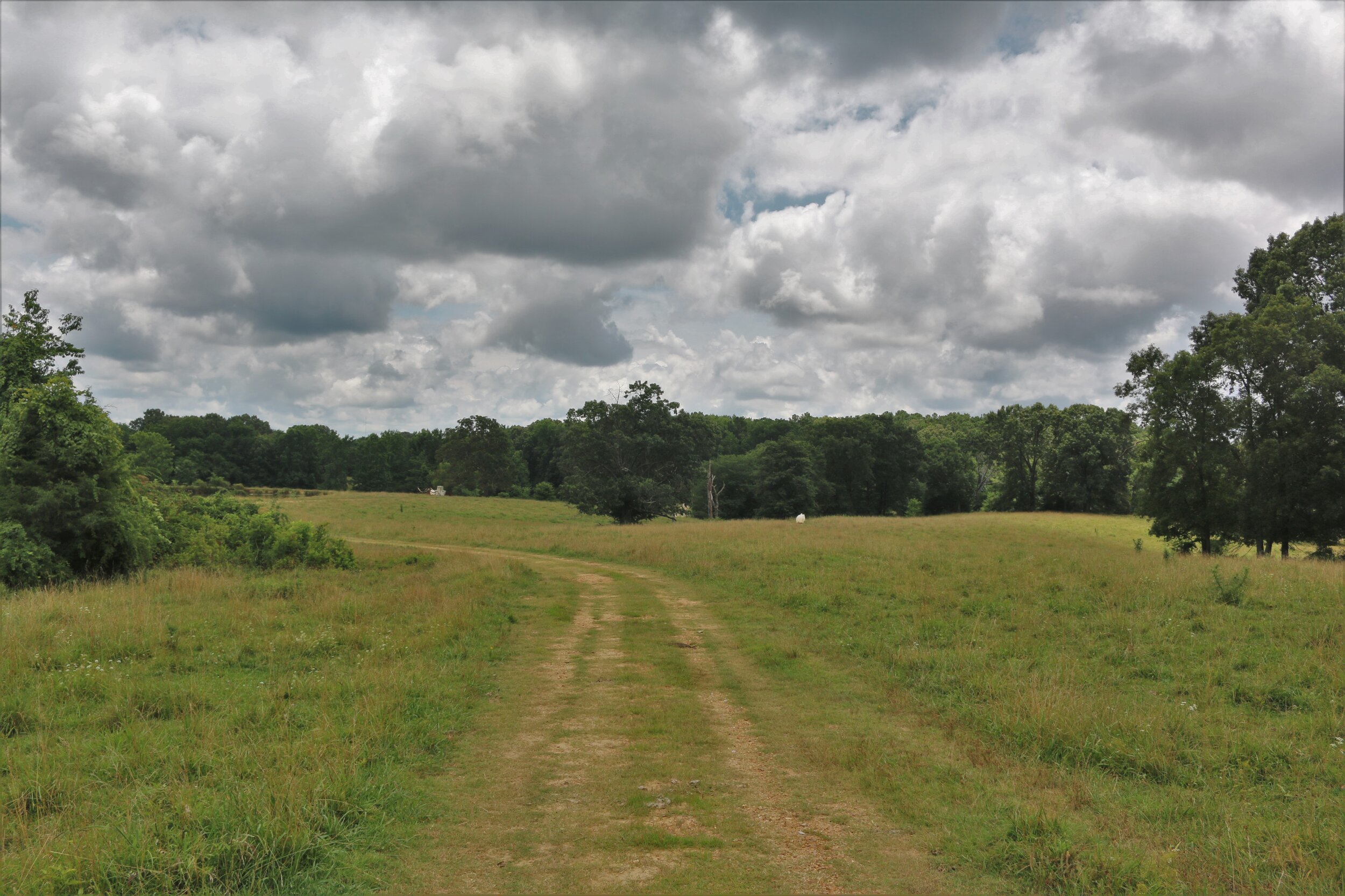
• Simmons Land Company
  • Properties For Sale
  • Links
  • Contact
Menu

Simmons Land Company

Farm & Timber Properties
  • Simmons Land Company
  • Properties For Sale
  • Links
  • Contact

4,000 Acre Triple Creek Ranch

Price: $60,000,000

Total Acres: 4,000

Open Acres: 192 Acres

Taxes: $92,820.26

Location: The 4,000 acre Triple Creek Ranch is a premier land offering that boasts numerous named streams, springs, mature hardwoods and serene meadows, which all contribute to a pristine, naturally exclusive location set amongst nature. There are many well-developed recreational amenities anchored with a twelve stall equestrian facility, fenced paddocks, 40 miles of trails, 18 plus miles of streams, wildlife food plots, a private airstrip, hanger, shop, several cabins, an abundance of wildlife and an excellent location.

A short 30-minute drive southwest of Nashville, Tennessee, the property is the largest tract in Williamson County and located just 3.4 miles from the quaint community of Leipers Fork, home to many of the artist and legends in the Nashville Music Business. Williamson County is the wealthiest and fastest growing county in Tennessee with currently over $4 Billion in recent developments. Bounded on the west by Nashville’s 840 Loop, the Property is ideally suited for an conservation development.

Road Frontage: The property has over a mile of frontage on the 77 mile I-840 beltway at the Pinewood Exit. The beltway was proposed as a solution for regional traffic needs so existing Nashville freeways could better support local traffic. I-840 forms a complete bypass of the Nashville metropolitan area and has opened up the land up for commercial and residential development. The property also has over three miles of paved county road frontage on Pewitt Road, Boy Scout Road, Taylor Cemetery Road, Hargrove Road and Pinewood Road.

Trails & Streams: There are over 40 miles of hiking trails, horseback riding trails and year round interior roads that provide access to all portions of the property. The 192 acres of open land is used for pasture and food plots. There are 18 plus miles of perineal creeks and large named streams and the balance of the land is primarily in old growth hardwood forest. The topography can best be described generally as ridge top to ridge top with fertile valleys between. The current owner spent twenty years assembling what is now the largest contiguous tract in Williamson County. It is one of the most unique and beautiful properties left in the Southeast.

Clubhouse/Barn: The main entrance to the farm is located at the 5600 Boy Scout Road. The 4500-foot paved private drive has an electric gate at the entrance and is fenced with guardrails lining the side of the drive as it descends into the valley to the clubhouse. The interior of the clubhouse contains a total of 4,564 square feet of finished space. The first floor contains 2,974 feet with an authentic western bar, country store, full country kitchen, office, full bath and even an old jail cell with bunk beds. The second floor contains 1,770 square feet of living space, which the Seller resides. It has a large stone fireplace, kitchen, den, laundry room, and contains two bedrooms and two baths. The covered portion of the barn covers over 35,000 square feet and has an indoor riding ring, twelve stalls, wash room, two bathrooms and paved parking. The entrance to the Clubhouse/Barn from the covered area looks like an old west town complete with balconies, porches and vintage, wavy glass windows. Rain or shine, this area can be used to host large concerts, company parties or other such large events. The wood panels circling the riding ring are removeable, thus creating almost an acre of open space under roof.

The quality of the woodwork and attention to detail throughout the clubhouse is stunning. The floors are oak, the wall paneled with upholstery accents, tin tile ceilings and a huge stone fireplace which serves as the focal point of the room. A stage was built for live performances, complete with mic plugins, adjustable lighting, built in speakers and a studio quality sound board to manage and mix the sound.

Improvements: There is a hand hewn log cabin used as a guest cottage near the Clubhouse/Barn and an additional two other cabins located deep into the property that have been used by many of the songwriters in the area. A spacious managers house is located at the end of Taylor Cemetery Road. The is a grass landing strip on the property located by the Clubhouse/Barn airstrip with a hanger right off the strip. A large metal, concrete floor shop and equipment shed is located nearby. The property has a nice horse and hay barn off Taylor Cemetery Road with improved pastures that are fenced and cross fenced. There are several other pole barns and equipment sheds scattered through the 4,000 acres.

Timber: The timber on the property is excellent and consist primarily of mature hardwood trees. A very small amount of the timber has been harvested in the last twenty five years and a large percentage of the timber is ready to be harvested. A timber cruise on approximately 1675 acres is available upon request

Conservation Easement: There are 32 acres, known as the Brown Tract, under a Conservation Easement managed by the Tennessee Nature Conservancy. It is restricted from development with the exception of the right to build one house. There is also an easement on an adjoining 124 acres restricting it from all development which is also managed by Tennessee Nature Conservancy.

Contact to View the Property:

John Simmons

Simmons Land Company

Farm & Timber Properties

john@simmonsland.com

www.simmonsland.com

901 828-5500

Howard Bickerstaff

Bick Real Estate Co., LLC

howard@bickrealestate.co

triple-creek-ranch.com

423 605-6500

Total Acres: 4,000 Acres: 192 Acres

Price: $60,000,Additional Information

Approximate Road Frontage

Pewitt Rd. – 2,950 feet

Boy Scout Rd: 5,500 feet

Taylor Cemetery Road: 1,865 feet

Pinewood (Hwy 46): 1,150 and 310 feet

Hargrove Road: 3, 982 feet

I-385: Over one mile of frontage

Approximate Linear Stream Frontage

Copper Branch 1.45 miles

White Oak Branch: 1.09 Miles

Kelley Creek: 2.31 miles

Arkansas Creek: 2.5 Miles

Inman Branch: 1.64 Miles

Blowing Springs Branch: 3600 ft.

Coleman Branch: 1500 ft.

*There are many more branches and feeder streams not measured.

Triple Creek Ranch

Improvements (Tax Records)

Clubhouse/Barn: 4,564 sq. ft.

1st floor: 2,794 sq. ft.

2nd Floor: 1,170 sq. ft.

Stable: 2,550 sq. ft.

Hanger: 1,760 sq. ft.

Shop Building: 2,880 sq. ft.

Pole barn attached to Main Barn: 33,684 sq. ft.

Dwelling: 480 sq. ft.

Lean to: 480 sq. ft.

Pole Building: 1,440 sq. ft.

WDDK-R: 224 sq. ft.

WDDK-R: 250 sq. ft.

Utility Shed: 144 sq. ft.

Dwelling: 1,668 sq. ft.

Detached Garage: 288 sq. ft.

FlatCP: 432 sq. ft.

Loafing: 300 sq. ft.

Loafing: 450 sq. ft.

Concp:: 288 sq. ft.

Concp: 120 sq. ft.

Screen Shot 2018-03-12 at 11.56.57 AM.png
fullsizeoutput_878.jpeg
4000 Rd 9.0.jpg
fullsizeoutput_224a.jpeg
fullsizeoutput_2113.jpeg
 Western bar

Western bar

IMG_0680.jpg
IMG_0672.jpg
IMG_0671.JPG
IMG_0645.jpg
IMG_0650.jpg
IMG_0644.jpg
fullsizeoutput_221c.jpeg
fullsizeoutput_224c.jpeg
fullsizeoutput_22fe.jpeg
fullsizeoutput_227d.jpeg
fullsizeoutput_2238.jpeg
fullsizeoutput_2225.jpeg
fullsizeoutput_171c.jpeg
fullsizeoutput_22cc.jpeg
fullsizeoutput_2233.jpeg
fullsizeoutput_22ed.jpeg
fullsizeoutput_22fc.jpeg
fullsizeoutput_22cb.jpeg
fullsizeoutput_2223.jpeg
fullsizeoutput_22f9.jpeg
fullsizeoutput_2231.jpeg
fullsizeoutput_22f2.jpeg
fullsizeoutput_225e.jpeg
20150205_192256000_iOS.jpg
fullsizeoutput_2259.jpeg
fullsizeoutput_2253.jpeg
fullsizeoutput_2257.jpeg
fullsizeoutput_225f.jpeg
fullsizeoutput_2264.jpeg
fullsizeoutput_2265.jpeg
fullsizeoutput_2260.jpeg
fullsizeoutput_3b.jpeg
fullsizeoutput_2277.jpeg
fullsizeoutput_37.jpeg
fullsizeoutput_227e.jpeg
thumb_thumb_IMG_0586_1024_1024.jpg
thumb_thumb_IMG_0587_1024_1024.jpg
 Leipers Fork   

Leipers Fork


fullsizeoutput_34.jpeg
fullsizeoutput_229b.jpeg
fullsizeoutput_2299.jpeg
fullsizeoutput_228d.jpeg
fullsizeoutput_22f1.jpeg
fullsizeoutput_2222.jpeg
fullsizeoutput_2237.jpeg
fullsizeoutput_223c.jpeg
fullsizeoutput_223d.jpeg
fullsizeoutput_221e.jpeg
fullsizeoutput_2292.jpeg
fullsizeoutput_221f.jpeg

220 ac Fayette County SOLD

220 acre located on Raleigh LaGrange Road west of Hwy 194 at Blain Road. Approximately 150 acres in cultivation, 60 acres in mature hardwood and 20 acres of pasture where the house and barn are located overlooking the property. The house was built in the early 1900's and  has narrow heart pine floors and pine paneling on the walls and ceilings. The windows are original and the kitchen has a  very old gas stove. Needs work, but rentable now. The farmland is level and excellent ground. This is one of the best farms in Fayette County and well located between Hwy 196 and Hwy 194 in Rossville, TN. Call me to view the farm.

John Simmons 901 828-5500


fullsizeoutput_858.jpeg
fullsizeoutput_2304.jpeg
DSCN0105.JPG
DSCN0106.JPG
fullsizeoutput_230e.jpeg
DSCN0110.JPG
DSCN0112.JPG
fullsizeoutput_2311.jpeg
fullsizeoutput_2310.jpeg
fullsizeoutput_2315.jpeg
fullsizeoutput_231a.jpeg
DSCN0166.JPG
fullsizeoutput_1c.jpeg
DSCN0019.JPG
fullsizeoutput_231f.jpeg
DSCN0023.JPG
DSCN0025.JPG
fullsizeoutput_2297.jpeg

3,828 ac. Centerville, TN

Total Acres: 3,828.22 acres. Surveyed 1/12/18.

Location: Centerville, TN, 47 miles Southwest of Nashville.

Price: $4,785,000 ($1,250/ac)

Property: Roads throughout the property to access all parts. Incredible deer and turkey hunting. Would make an excellent hunting club being only 45 minutes from Nashville.

Note: The owners would consider dividing the property into two or three parcels. The land is priced to sell.

John Simmons 901 828-5500

Screen Shot 2017-12-11 at 12.17.41 PM.png
Screen Shot 2017-12-11 at 12.18.21 PM.png
Screen Shot 2017-12-11 at 12.17.02 PM.png
Screen Shot 2017-12-11 at 12.16.41 PM.png
C7029D78-51D0-4230-A5B8-2C16FA3F64F0.jpeg
20E6C57F-FBA7-448C-96CA-6189A8674989.jpeg
9B33E5CA-9EC9-4086-ACA3-321620F4A61C.jpeg
7A3C6001-DCA9-40BE-AC6C-66346A91F51D.png
1938B796-6AE6-43CC-9588-A4BCD766A975.jpeg
388B2CD8-7A91-4A7A-8D15-5FBD0E2B6262.jpeg
6EA0DEB4-8366-4136-AC32-321BFB8E4C2C.jpeg
5B6788CD-683F-46C3-98A0-AE1A17171E0E.jpeg
A0B7F582-2FB2-4EF0-8F53-F5D2DA5183EF.jpeg

583 Acres-Fayette County

583 acre Mann Farm
Fayette County, Tennessee

Location: Approximately 4.5 miles north off Rossville, TN with approximately 2,500 feet of frontage on he east side of Hwy. 194. The farm also fronts on the western side of Murrell Road for approximately 3,500 feet.

Price: $6,000/acre or $3,532,500
 (Divisions and serious offers considered)  

   
Farmland: 583 acres
FSA Cropland: 323.1 acres
Timber: 260 acres
Farm Number: 4992
Tract Numbers: 750, 6681 and 6718.

Farm Lease: 2018-2021 (Four Years, Subject to Sell) $27,000 Annually,

Tenant: Glenn Hopkins

Hunting Lease:2018-2022 (5 years subject to Sell), $7,500/ac Annually


Cotton Base: 84.7 acres
Corn Base: 33.3 acres .
Grain Sorghum Base: 20.3 acres
Soybean Base: 46.6 acres
RENT: Cash rent of $21,000 ($25/ac for the 150 acres in pasture and $100/ac for the 173 acres in row crop).


IMG_1342.JPG
JohnsonFarm copy.jpg
 583 acre Mann Farm Fayette County, Tennessee  Location: Approximately 4.5 miles north off Rossville, TN with approximately 2,500 feet of frontage on he east side of Hwy. 194. The farm also fronts on the western side of Murrell Road for approximately 3,500 feet.  Price: $7,000/acre or $4,081,000  (Divisions and serious offers considered)          Farmland: 583 acres  FSA Cropland: 323.1 acres Mature Timber: 260 acres Farm Number: 4992  Tract Numbers: 750, 6681 and 6718.   Cotton Base: 84.7 acres with a Direct Yield of 501 and CC Yield of 814 #’s. Corn Base: 33.3 acres with a Direct Yield of 70 bu. and CC Yield of 60 bu. Grain Sorghum Base: 20.3 acres with a Direct Yield of 45 bu. and CC Yield of 60 bu.  Soybean Base: 46.6 acres with a Direct Yield of 17 bu. and CC Yield of 21 bu. TERM: January 1, 2012 and terminating December 31, 2013. RENT: Cash rent of $21,000 ($25/ac for the 150 acres in pasture and $100/ac for the 173 acres in row crop).  Payment Due: December 1

583 acre Mann Farm
Fayette County, Tennessee

Location: Approximately 4.5 miles north off Rossville, TN with approximately 2,500 feet of frontage on he east side of Hwy. 194. The farm also fronts on the western side of Murrell Road for approximately 3,500 feet.

Price: $7,000/acre or $4,081,000
 (Divisions and serious offers considered) 

      
Farmland: 583 acres 
FSA Cropland: 323.1 acres
Mature Timber: 260 acres
Farm Number: 4992 
Tract Numbers: 750, 6681 and 6718.


Cotton Base: 84.7 acres with a Direct Yield of 501 and CC Yield of 814 #’s.
Corn Base: 33.3 acres with a Direct Yield of 70 bu. and CC Yield of 60 bu.
Grain Sorghum Base: 20.3 acres with a Direct Yield of 45 bu. and CC Yield of 60 bu. 
Soybean Base: 46.6 acres with a Direct Yield of 17 bu. and CC Yield of 21 bu.
TERM: January 1, 2012 and terminating December 31, 2013.
RENT: Cash rent of $21,000 ($25/ac for the 150 acres in pasture and $100/ac for the 173 acres in row crop).

Payment Due: December 1

mann fsa 1.JPG
mann fsa 3.JPG
Image.jpg
IMG_0003.JPG
IMG_0015.JPG
IMG_0002.JPG
IMG_1336.JPG
IMG_1335.JPG
IMG_2028.JPG
IMG_2029.JPG

600 acres Marshall County, MS

JA-BAR Timber Farm

598 acres

IMG_2031.jpg
IMG_2022.jpg
IMG_1984.jpg
IMG_1967.jpg
IMG_2033.jpg
IMG_2024.jpg
IMG_1966.jpg
IMG_2025.jpg
IMG_2021.jpg
IMG_1961.jpg
IMG_1962.jpg
IMG_1988.jpg
IMG_2003.jpg
IMG_2035.jpg
IMG_2036.jpg
IMG_2039.jpg
IMG_2041.jpg
IMG_1967.jpg
IMG_2015.jpg
IMG_1991.jpg
IMG_1994.jpg
IMG_1993.jpg
thumb_IMG_5949_1024.jpg
IMG_0116.JPG
IMG_0117.JPG

962 Acres - Deeson, MS

Contact John Simmons at Simmons Land Company ​901-828-5500. ​

DSCN0032.JPG
DSCN0031.JPG
Deeson Location.jpg
Deeson Roads.jpg
Deeson Topo.jpg
Deeson Topo 13.jpg
Deeson Aerial.jpg
DSCN0036.JPG
_SLC2237.JPG
_SLC2226.JPG
DSCN0040.JPG
DSCN0042.JPG
DSCN0035.JPG
DSCN0033.JPG
DSCN0034.JPG

315 Acres - MS River Timber Land

IMG_1023.JPG
315 acres Topo 11.jpg
Topo 13.jpg
Shannon 315 acres.JPG
Stewart land.JPG
IMG_1020.JPG
IMG_1032.JPG
IMG_1033.JPG
IMG_1056.JPG
IMG_1036.JPG
IMG_1034.JPG
IMG_1027.JPG
IMG_1020.JPG
IMG_1044.JPG

170.67 Acres - Fayette County, TN

Contact John Simmons at Simmons Land Company 901-828-5500.

DSC_4120.JPG
DSC_4108.JPG
Hunt Color Aerial.jpg
Hunt-Tax Aerial.JPG
Hunt Topo.jpg
DSC_4118.JPG
DSC_4116.JPG
DSC_4115.JPG
DSC_4114.JPG
DSC_4113.JPG
DSC_4112.JPG
DSC_4111.JPG
DSC_4119.JPG
DSC_4104.JPG
DSC_4102.JPG
DSC_4101.JPG

84 Acres - Sapphire, NC

For a video tour of the property click here.  For a drone view https://youtu.be/lrm8i0HBjLE. This property is located in Western North Carolina in Sapphire Valley, fifteen minutes from downtown Cashiers. The tract is bordered by the Nantahala National Forest on the entire west side. The Thompson River runs through the middle of the property. The property is located off Upper Whitewater Road and by an access road through Camp Buc. The access is deeded and recorded. It is rare to find a property with river frontage and one adjoining the Nantahala National Forest. There are hundreds of thousands of acres in this immediate area of National Forest. If you love the outdoors and want a place to hunt, fish, or just get away for a while, I don't think you will find a prettier place.

If you have any interest in seeing the property, call me at anytime: John Simmons, Owner/Agent (901) 828-5500

IMG_3812.JPG
11110168_10154008757319517_5250535212346578020_o.jpg
IMG_3866.JPG
IMG_3800.JPG
IMG_3851.JPG
Sapphire Location.jpg
NC 14 A.jpg
NC ROADS.jpg
84.18 Aerial.jpg
qz38TP.jpeg
84.18 Topo.jpg
uCLWfP.jpeg
MR50cw.jpeg
W3p0Cu.jpeg
IMG_3829.jpg
IMG_3808.JPG
IMG_3809.JPG
IMG_3817.JPG
IMG_3825.JPG
IMG_3851.JPG
IMG_3862.JPG
IMG_3863.JPG
Screen Shot 2015-06-28 at 1.58.16 PM.jpg
Screen Shot 2015-06-28 at 2.12.34 PM.png
886026_10154008757154517_8886468629904122453_o.jpg
1493477_10154008757434517_8701975974910365879_o.jpg
1518303_10154008757304517_2909012203556913584_o.jpg
1932508_10154008757309517_7634053654803781723_o.jpg
11313152_10154008757314517_2671396952624995175_o.jpg
11537479_10154008757439517_6673576548917797818_o.jpg
11539078_10154008757039517_1926888499978375048_o.jpg
11696359_10154008748474517_6984032193911166928_o.jpg
11696640_10154008757044517_6325989141979464714_o.jpg
11700942_10154008757449517_9003747664195052978_o.jpg
11703429_10154008757034517_8462018009293561827_o.jpg
11703460_10154008757324517_4238633377748097715_o.jpg
Sapphire

Le Petite Chatecallie: SOLD


James Means, Architect

James Collier Means (1904–79), known simply as Jimmy, was a Georgia architect of the “old school”; he was a steadfast classicist when the suburban ranch house, with a streamlined Ford in the carport, had become an ideal for a postwar futuristic world. Commenting on a modern new church building with an oddly angled metallic steeple, Means remarked characteristically to a client, “That church is unnecessarily ugly.” This droll and definitive way of speaking endeared him to his clients, many of whom became his close friends, finding him and his work irresistible. His work was his life.

Means and his clients loved the pre-expressway past. They took great pains, and pleasure, too, in breathing new life into the symmetrical beauties of eighteenth-century American and European styles, usually understated vernacular versions, and they preferred the comfortable “old shoes” of seasoned building materials, handcrafts, antique furnishings, and parterre gardens. Despite a changing society (or possibly because of it), this continuity seemed necessary and appropriate for life in modern America, especially in the South where Means was born and learned architecture as his profession.

He learned in the old-fashioned way, on the job, rather than in a college of architecture. Means was only a young teenager when he began to work part time as an office boy in 1917 with a premier Atlanta architectural firm, Hentz, Reid & Adler. By age fifteen he was drafting such things as roof plans and was on his way to becoming a card-carrying member of the Georgia school of classicists. His credentials were based on his unique talents, experience, and knowledge rather than on registration with a state agency, and he was not a member of the American Institute of Architects.

Means was one of the last of the master builders, the original meaning of architect. Not just capable of using the T-square, drafting paper, and pencil, he had also mastered the traditional tools of the carpenter-architect. He grounded his practice in the old ways of designing and building based in the human scale of the proportional systems of the classical orders and in enduring materials such as bricks, stone, and heart pine. He was a professional because he was a perfectionist, and people were drawn to him and his work for that reason, allowing him to earn a modest living as an architect for his entire adult life. Everyone knew Jimmy Means was not in the profession for the money, but for the art.

The houses that Means designed and built from the early 1950s, when he returned to Atlanta from Albany and Jones & Means to practice alone, without draftsmen or secretary, are the culmination of more than seventy years of Georgia classicism growing out of Hentz, Reid & Adler and Hentz, Adler & Shutze. Means, his clients, contractors, masons, millworkers, and carpenters greatly enriched the tradition when few could still do it or afford it, or care.

 John Simmons

Owner/Agent


Lookout Mountain Estate

Le Petite Chatecaille

Lookout Mountain, Georgia

Owner/Agent


$3,500,000.


Le Petite Chatecaille was built in 1961 by Master builder Winston Bland, according to the plans and specifications of architect James Means. It is a replica of the Chateau Chatecaille in Touraine, France. The home sits on approximately 11 acres on the West Brow of Lookout Mountain and has a spectacular view of Lookout Valley. The house contains 10 bedrooms, 8 full baths, and 2 half baths, and approximately 16,000 sq. ft.

The brick and cobblestones in the courtyard were taken from a razed antebellum mansion from outside of Chattanooga. The roof tiles are made by Ludobichi and Means had thin wooden lathes placed under the tiles to give them the wavy effect that comes with age.

There are 4 types of antique marble in the entry foyer: Sienna, Cipolin, Verde Antique, and Rouge Royal. The tiles were hand cut in Italy, shipped to Lookout Mountain, and were assembled like a giant jigsaw puzzle.

At either end of the foyer are demi-lune alcoves, which are lined with rare 1820 Dufour hand blocked watercolor panels. We are told that there were only 16 of these panels ever printed, and two are in the home; two in the Hermitage, the home of President Andrew Jackson; two are in the White House; two in the Smithsonian in Washington, DC. The other eight panels are unaccounted for.

Just above the alcoves are plaster shells, the plasterer being an Italian artisan known as Juliano, who had also done work in the Vatican.

The small stair foyer to the right of the entry foyer features a large sterling silver chandelier. The left wing large stair foyer features a pair of eighteenth century ancestral over door portraits custom framed by H. Millard. The staircases of both the small and large foyers are custom made Versailles patterned iron and brass railings and balustrades . The paneling in the drawing room is period Louis 16th boiserie paneling and was taken from a mid-1700’s Parisian townhouse. The paneling still has the original celadon color paint. The paneling has been restored, but never repainted- the same with the turquoise and cerulean blue moldings. Mr. Juliano also executed the over doors and niches.

The fireplace mantle is made from rare blue and white Saint Anne marble, of which none has been found since the days shortly after Louis 16th’s death. The exquisite trumeau mirror above the mantle is original to the Parisian town house.

The chandelier in the dining room is Waterford crystal.. The fireplace features a carved stone facing and a carved wood Louis XVI mantle and over mantle, with a 1740 oil painting insert by French artist Monnoyer. The faux marble medallions under the bay window, the faux marble baseboards, and the decorative over door panels are all the work of Mr. Juliano.


IMG_2693.JPG
DSC_9718.JPG
IMG_0578.JPG
IMG_0056.JPG
IMG_0890.jpg
IMG_2156.jpg
DSC_9479.JPG
DSC_9717.JPG
IMG_0052.JPG
IMG_2160.jpg
IMG_2171.JPG
IMG_0338.JPG
IMG_0539.JPG
IMG_0540.JPG
IMG_0546.JPG
IMG_0564.JPG
IMG_0565.JPG
IMG_0569.JPG
IMG_0570.JPG
IMG_0573.JPG
IMG_0580.JPG
IMG_0597.jpg
IMG_0598.jpg
IMG_2158.jpg
IMG_2159.JPG
IMG_2165.jpg
IMG_2166.jpg
DSC_9472.JPG
DSC_9715.JPG
DSC_9720.JPG
DSC_9734.JPG
DSC_9738.JPG
IMG_2155.JPG

4,487 Acres-VA-SOLD

4487.jpeg
rs_051813brandon3-large.jpg
timthumb-17.jpeg
IMG_0626.jpg
IMG_0615.jpg
                  BRANDON PLANTATION    Acreage  FSA Tract Number: 541Total Acres: 4,487 acres FSA Cropland: 1,576.97 acres FSA Double Crop Acres: 669 acres Timberland: 2,848 acres Balance: 63 acres (House sites, roads, etc.)   Location    Prince George County, Virginia, 108 miles south of Washington DC,   30 miles southeast of Richmond, Virginia and 62 miles northwest of Virginia Beach, Virginia..   Description  Brandon Plantation is a contiguous 4,487-acre plantation located in Prince George County, Virginia, on the James River and Upper Chippokes Creek approximately 30 miles southeast of Richmond, Virginia. It is one of the oldest continuous farming operations in the United States and is one of the finest working farms in Virginia.   The circa 1765 brick residence is cited in the National Register application as “one of the most sophisticated of Virginia’s eighteenth century structures. Next to Monticello, it is probably the most purely palladium Virginia home of its Period.” The residence and curtilage cover approximately 60 acres, including roughly 30 acres of grounds and gardens running to the river. Brandon Plantation is a single parcel and contiguous tract of land that is well suited for timber and row crop production.  The topography of the farm is level to gently sloping and it has extensive frontage on the James River and the Upper Chippokes Creek. The row crop ground is situated on the riverside of the property and the timberland primarily on the opposite end. The fields are unusually large for this region of Virginia and thus more efficient to farm.  Brandon Plantation is a highly productive farm and well managed for row crop and timber production.   Crop Bases   Wheat: 655.9 acres/ 60 bu. direct yield Corn: 623.5 acres/ 108 bu. direct yield Soybeans: 737.3 acres/ 29 bu. direct yield Barley: 40.3 acres/ 59 bu. direct yield    Soils  The Pamunkey Soil Series is the predominant soil type on Brandon Plantation. The Virginia Association of Professional Soil Scientist selected Pamunkey as the Virginia State Soil. Pamunkey is considered to be the best soil type in Virginia and is designated as a Class 1 soil with 0-2% slopes. The predominant Pamunkey soil and the expansive row crop acreage is truly rare in Virginia, particularly on farms as large as Brandon Plantation. Pamunkey soils have a high natural fertility and produce high yielding crops. They are deep, well drained, and nearly level. Typically, they have a sandy loam surface layer and sandy clay loam subsoil underlain by sandy and loamy substrata. They were the first soils used to grow crops by the settlers in Jamestown and probably the reason the settlements survived. The soil was named after a nearby river that was named for the Pamunkey Indian Nation that also farmed this rich soil. The other soil types of significance include Argent silt loam, Bojac loamy sand, and Bolling silt loam.   Improvements  Barn/Sable: 50x150 (two-story brick with hay storage) Barn/Stable: 40x151 (two-story brick with hay storage) Steel Utility Shed: 48x100 Steel Utility Shed: 40x50 Stable: 34x55 Stable: 34x55 Pole Building: 30x80 Pole Building: 30x55 (two-story) Pole Building: 53x118 Pole Building: 28x70 Pole Building: 26x28 Pole Building: 50x56 Lean-to: 3x93 Lean-to: 26x38 Lean-to: 18x150 Garage/Shed: 22x40 Machine Shed: 10x6 Tile Silo with Copper Roof Farm Office: 60x18 11 Dwellings and 2 Apartments The farm has a grain storage facility that the farmer is currently using to store approximately 62,000 bushels of corn.   County Road Frontage  Brandon Road Upper Brandon Road Willow Hill Road Chippokes Road James River Road Point Road         


               BRANDON PLANTATION

Acreage
FSA Tract Number: 541Total Acres: 4,487 acres
FSA Cropland: 1,576.97 acres
FSA Double Crop Acres: 669 acres
Timberland: 2,848 acres
Balance: 63 acres (House sites, roads, etc.)

Location

Prince George County, Virginia, 108 miles south of Washington DC,

30 miles southeast of Richmond, Virginia and
62 miles northwest of Virginia Beach, Virginia..

Description
Brandon Plantation is a contiguous 4,487-acre plantation
located in Prince George County, Virginia, on the James River
and Upper Chippokes Creek approximately 30 miles southeast
of Richmond, Virginia. It is one of the oldest continuous
farming operations in the United States and is one of the finest
working farms in Virginia. 

The circa 1765 brick residence is cited in the National Register application as “one of the most sophisticated of Virginia’s eighteenth century structures. Next to Monticello, it is probably the most purely palladium Virginia home of its Period.” The residence and curtilage cover approximately 60 acres, including roughly 30 acres of grounds and gardens running to the river. Brandon Plantation is a single parcel and contiguous tract of land that is well suited for timber and row crop production.

The topography of the farm is level to gently sloping and it has extensive frontage on the James River and the Upper Chippokes Creek. The row crop ground is situated on the riverside of the property and the timberland primarily on the opposite end. The fields are unusually large for this region of Virginia and thus more efficient to farm.  Brandon Plantation is a highly productive farm and well managed for row crop and timber production.

Crop Bases

Wheat: 655.9 acres/ 60 bu. direct yield
Corn: 623.5 acres/ 108 bu. direct yield
Soybeans: 737.3 acres/ 29 bu. direct yield
Barley: 40.3 acres/ 59 bu. direct yield


Soils
The Pamunkey Soil Series is the predominant soil type on Brandon Plantation. The Virginia Association of Professional Soil Scientist selected Pamunkey as the Virginia State Soil. Pamunkey is considered to be the best soil type in Virginia and is designated as a Class 1 soil with 0-2% slopes. The predominant Pamunkey soil and the expansive row crop acreage is truly rare in Virginia, particularly on farms as large as Brandon Plantation. Pamunkey soils have a high natural fertility and produce high yielding crops. They are deep, well drained, and nearly level. Typically, they have a sandy loam surface layer and sandy clay loam subsoil underlain by sandy and loamy substrata. They were the first soils used to grow crops by the settlers in Jamestown and probably the reason the settlements survived. The soil was named after a nearby river that was named for the Pamunkey Indian Nation that also farmed this rich soil. The other soil types of significance include Argent silt loam, Bojac loamy sand, and Bolling silt loam.

Improvements
Barn/Sable: 50x150 (two-story brick with hay storage)
Barn/Stable: 40x151 (two-story brick with hay storage)
Steel Utility Shed: 48x100
Steel Utility Shed: 40x50
Stable: 34x55
Stable: 34x55
Pole Building: 30x80
Pole Building: 30x55 (two-story)
Pole Building: 53x118
Pole Building: 28x70
Pole Building: 26x28
Pole Building: 50x56
Lean-to: 3x93
Lean-to: 26x38
Lean-to: 18x150
Garage/Shed: 22x40
Machine Shed: 10x6
Tile Silo with Copper Roof
Farm Office: 60x18
11 Dwellings and 2 Apartments
The farm has a grain storage facility that the farmer is currently using to store approximately 62,000 bushels of corn.

County Road Frontage
Brandon Road
Upper Brandon Road
Willow Hill Road
Chippokes Road
James River Road
Point Road


IMG_0711.jpg
Brandon 10.7c.jpg
IMG_0681.jpg
Brandon 10.7c.jpg
BP Quad.jpg
BP Color Aerial 1.jpg
IMG_0719.jpg
IMG_0621.jpg
IMG_0565.jpg
IMG_0648.JPG
IMG_0582.jpg
IMG_0576.jpg
IMG_0563.jpg
IMG_0566.jpg
IMG_0575.jpg
IMG_0648.jpg
IMG_0576.jpg
IMG_0577.jpg
IMG_0574.jpg
IMG_0700.jpg
timthumb-18.jpg
IMG_0688.jpg
IMG_0660.jpg
IMG_0663.jpg
IMG_0708.jpg
IMG_0587.JPG
IMG_0609.JPG
IMG_0587.JPG
IMG_0622.jpg

1410 Ac SOLD

$4,935,000 ($3,500 per acre) FIRM. 

Benton County Farm

1410.82 acres

Price: $3,500/acre Firm

Total FSA Acres: 1429.34 (Includes 19+ acres and house that is out)
FSA Cultivatable Acres: 948.02

Location: Benton County, MS on the north side of Highway 72 northwest of the intersection of Highway 72 and Hwy 5. The farm also fronts on Harris Chapel Road, which is a county black top road, Mosquito Road, a county gravel road and Trimble Road, which is paved road. 


Income & Improvements


Improvements: There is a house and one cabin on the property and a several grain bins. The house is rented for $600/month ($7,200 annually) and the cabin is used by the hunters that lease the hunting rights.

Hunting Lease: The land is leased for hunting until August 2015 for $12,000. It could possible be terminated at closing. The hunters have the use of the hunting cabin on the Property. The farm has a beaver kill area that is flooded (40 acres+) on the north end and has excellent duck hunting. There are several ponds and lakes on the property.

Farm Rent: McNabb Farms has been farming the land for several years. The farm rent is being renegotiated now. The past lease was for $85 per cultivated acre or $80,581. I would estimate the farm could be rented for $125-$150 cash per cultivated acre.

Timber:  This farm has an excellent stand of hardwood timber. I have a standing offer from a timber buyer who will pay $400,000 for the timber deed at closing and cut the timber on halves. He estimates the owner would receive a total of $500,000 to $800,000 for his share of the timber value.

General
This is one the best farms in Benton County. The fields are large and level. It is unusual for a farm of this size to have such a high percentage of tillable acres and valuable timber for most of the balance. It has great road frontage and adjoins the Wolf River. There is also a paved landing strip in the large filed in the northwest corner of the property.

1410.jpg
1.jpg
1395519238393.jpg
Shockey 1410 Rd.jpg
Exhibit%202-1410_82%20Acres.jpg
1395517037701.jpg
F6337_T7831.jpg
1395517224278.jpg
1395517303880.jpg
F6337_T7832.jpg
1395517773881.jpg
1395517620770.jpg
2014-03-01 16.36.29.jpg
1395517695553.jpg
IMG_0187.JPG
2014-03-01 16.36.29.jpg
2014-03-01 16.37.38.jpg
IMG_2113.JPG
IMG_2115.JPG
IMG_2026.JPG
IMG_0199.JPG
IMG_0197.JPG
IMG_0117.JPG
IMG_0202.JPG
IMG_0188.JPG
IMG_0185.jpg
IMG_0165.JPG
IMG_0161.JPG
IMG_0140.JPG
IMG_0143.JPG
IMG_0139.JPG
IMG_0137.JPG
IMG_2077.JPG

1245 Acres - SOLD

Contact John Simmons at Simmons Land Company 901-828-5500.

Untitled-1.jpg
1245Pic (37).JPG
1245Pic (20).jpg
1245Pic (1).jpg
Boundary Topo.jpg
1245.jpg
1245A.jpg
1245R.jpg
1245Pic (31).JPG
1245Pic (30).JPG
1245Pic (3).jpg
1245Pic (7).JPG
1245Pic (19).jpg
1245Pic (10).JPG
1245Pic (11).JPG
1245Pic (49).jpg

1128 ac Fayette County

Located just North of Rossville, TN on the West side of Hwy 194.

FSA 341 acres of cropland and the balance of 787 acres primarily in mature hardwood timber. Almost three miles of frontage on the Wolf River and part of a vast woodland corridor on the Wolf River. Incredible deer, duck and turkey hunting. Well located being only ten minutes from the intersection I-385 and Hwy 57. Fronts on Highway 194 and Johnson Road. Located in the dead center of the growth areas of Fayette County, TN and Marshall County, MS. A unique opportunity to own a large tract 30 minutes east of Memphis which produces good income from the farmland lease and timber harvest potential. 

F4530.jpg
1128 topo.jpg
1128 Color Timber.jpg
image2015-01-07 01-25-07.jpg
image2015-01-07 01-27-09.jpg
image2015-01-09 17-39-51.jpg
image2015-01-09 17-42-04.jpg
image2015-01-09 17-39-06.jpg
image2015-01-09 17-43-02.jpg
image2015-01-09 17-39-06.jpg
image2015-01-07 01-16-29.jpg
image2015-01-07 01-24-20.jpg
image2015-01-07 01-24-42.jpg
IMG_2525.jpg
IMG_2527.jpg
IMG_1341.jpg
IMG_1337.JPG
image2015-01-09 17-42-04.jpg
IMG_2534.jpg
IMG_2524.JPG
image2015-01-07 01-27-51.jpg

989 Ac. Nashville-SOLD

968 acres located on Nosegay Road in Dickson County, Tennessee. The land is approximately 30 minutes west of Nashville, TN and has frontage on Jones Creek. There are approximately 245 acres on the west side of Nosegay Road and the balance on the other side of the road.

The timber on the property is incredible with the 70% being White Oak, 10% Red Oak, and the remaining 20% being mixed species. The property was just cruised and there are over 6,120,000 BF with a current market value of $2,954,430. Please call for the price. John Simmons, 901 828-5500

989.JPG
IMG_0579.JPG
Crews 968 Color Aerial.jpg
Crews 968 Location.jpg
Crews 968 Roads.jpg
Crews 968 Topo.jpg
Crews 968 BW.jpg
crews 968.JPG
IMG_0445.jpg
IMG_0450.JPG
IMG_0458.jpg
IMG_0498.JPG
IMG_0475.JPG
IMG_0500.jpg
IMG_0474.JPG
IMG_0459.jpg
IMG_0578.JPG
IMG_0468.JPG
IMG_0466.jpg

540 Acres SOLD

Contact John Simmons at Simmons Land Company ​901-828-5500. ​

540.JPG
IMG_0338.JPG
IMG_0349.JPG
IMG_0341.JPG
IMG_0335.JPG
560 Aerial.jpg
560 Green Location.jpg
560 Green Topo.jpg
IMG_0332.JPG
IMG_0333.JPG
IMG_0334.JPG
IMG_0336.JPG
IMG_0339.JPG
IMG_0340.JPG
IMG_0343.JPG
IMG_0344.JPG
IMG_0347.JPG
IMG_0348.JPG
IMG_0351.JPG
IMG_0353.JPG
IMG_0354.JPG
IMG_0355.JPG
IMG_0356.JPG
IMG_0357.JPG
IMG_0358.JPG

418 acres SOLD

418 Acres benton County, MS

Located on Hwy. 72 30 minutes east of Collierville. 318 acres in cultivation, 52 acres in CRP and the balance in hardwood. Excellent location and a very level farm. Unusually high percentage of cultivated acres for this area. Good soil types and a sound investments. Listed for $3,500 per acre or $1,463,000. Call me: John Simmons 901 828-5500

420 Location.jpg
aerail bw 14.jpg
IMG_0055.JPG
IMG_0054.JPG
aerial bw.jpg
IMG_0170.JPG
Web Soil Survey_Page_1.jpg
IMG_0169.JPG
IMG_0172.JPG
IMG_0175.JPG
IMG_0183.JPG
IMG_0177.JPG
IMG_0178.JPG

283 Ac. Nashville-SOLD

283.JPG
DSC_9541.JPG
283 20 Mile Radius.jpg
283 Location.jpg
Aerial Tax Map.JPG
Street Tax Map.JPG
Delorme Aerial.jpg
Delorme Topo.jpg
Tennessee Property Data Detail_001.jpg
Tennessee Property Data Detail_002.jpg
DSC_9565.JPG
IMG_1351.JPG
IMG_1352.JPG
DSC_9582.JPG
IMG_1375.JPG
DSC_9563.JPG
IMG_1389.JPG
IMG_1391.JPG
IMG_1383.JPG
DSC_9562.JPG
DSC_9576.JPG
DSC_9577.JPG
IMG_1371.JPG
IMG_1380.JPG
IMG_1399.JPG
IMG_1392.JPG
IMG_1361.JPG
IMG_1392.JPG
IMG_1397.JPG
IMG_1421.JPG
IMG_1401.JPG
prev / next
Back to Properties For Sale
56
4,000 Acre Triple Creek Ranch
18
220 ac Fayette County $5200/ac
13
3,828 ac. Centerville, TN
thomas farm.JPG
0
2,864 ac. Benton County, MS
IMG_1342.JPG
13
583 Acres-Fayette County
JA-BAR Timber Farm
36
600 acres Marshall County, MS
DSCN0032.JPG
15
962 Acres - Deeson, MS
IMG_1023.JPG
14
315 Acres - MS River Timber Land
DSC_4120.JPG
17
170.67 Acres - Fayette County, TN
37
84 Acres - Sapphire, NC
Lookout Mountain Estate
34
Le Petite Chatecallie: SOLD
4487.jpeg
35
4,487 Acres-VA-SOLD
1410.jpg
33
1410 Ac SOLD
Untitled-1.jpg
16
1245 Acres - SOLD
F4530.jpg
21
1128 ac Fayette County
989.JPG
19
989 Ac. Nashville-SOLD
540.JPG
24
540 Acres SOLD
15
418 acres SOLD
283.JPG
31
283 Ac. Nashville-SOLD
0
2776 ac Quail Plantation
Screen+Shot+2019-01-28+at+11.35.07+AM.jpg
0
147 acres on Raleigh Lagrange Rd, Fayette County

Powered by Squarespace.